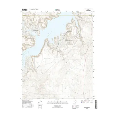
2016 Map of Alibates Ranch
USGS Topo · Published 2016About this map
Alibates Flint Quarries National Monument preserves a prehistoric industrial site where early inhabitants sourced high-quality stone, visible here along the eastern bluffs overlooking Lake Meredith. This 2016 survey illustrates the rugged drainage systems of the Texas Panhandle, including the deep cut of McBride Canyon and the winding course of Alibates Cr. The ranching history of Potter Co is represented by the Alibates Ranch and local pathways like Cas Johnson Rd and Alibates Trl. The map details a complex hydrologic network feeding into the Lake Meredith National Recreation Area, from the southern reaches of Mullinaw Cr to the permanent waters of Coldwater Spring, documenting the vital intersection of ancient human activity and modern water management.
Find a feature on this map
22 named features on this map. Tap any name to fly to it.
Don’t see what you’re looking for? This feature index may not catch every label — zoom into the map to look around manually.
Map Details
Editions of this 2016 Alibates Ranch Map
This is the sole edition of this map. No revisions or reprints were ever made.
Other maps of this area

1934 · Cliffside
USGS Topo · 1:62,500

1936 · Fourways
USGS Topo · 1:62,500

1936 · Cliffside
USGS Topo · 1:62,500

1939 · Sanford
USGS Topo · 1:62,500

1953 · Sanford
USGS Topo · 1:24,000

1953 · Chunky
USGS Topo · 1:24,000

1953 · Alibates Ranch
USGS Topo · 1:24,000

1953 · Evans Canyon
USGS Topo · 1:24,000

1953 · Deal
USGS Topo · 1:24,000

1953 · McDowell Creek
USGS Topo · 1:24,000