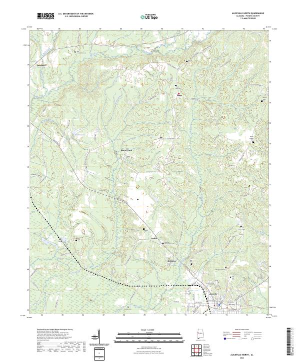
2024 Map of Aliceville North
USGS Topo · Published 2024About this map
Pickensville and the surrounding Alabama countryside are defined by a complex network of waterways, with Beaver Creek and Blubber Creek meandering through the rural landscape. This modern digital survey by the U.S. Geological Survey captures the contemporary layout of small communities like Beaver Town, Garden, and McMullen, providing a clear view of how decades of land divisions and local roads have shaped Pickens County.
Find a feature on this map
90 named features on this map. Tap any name to fly to it.
Don’t see what you’re looking for? This feature index may not catch every label — zoom into the map to look around manually.
Map Details
Editions of this 2024 Aliceville North Map
This is the sole edition of this map. No revisions or reprints were ever made.
Other maps of this area

1953 · West Point
USGS Topo · 1:250,000

1958 · West Point
USGS Topo · 1:250,000

1960 · Columbus
USGS Topo · 1:62,500

1963 · West Point
USGS Topo · 1:250,000

1966 · Reform SW
USGS Topo · 1:24,000

1967 · Carrollton
USGS Topo · 1:24,000

1970 · Aliceville North
USGS Topo · 1:24,000
1970 · Cunningham
USGS Topo · 1:24,000
1970 · Pleasant Ridge
USGS Topo · 1:24,000

1970 · Aliceville South
USGS Topo · 1:24,000