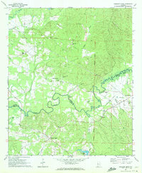
1970 Map of Pleasant Ridge
USGS Topo · Published 1972About this map
The Sipsey River meanders across the border of Pickens and Greene Counties, anchoring a rural landscape defined by small crossroads communities and family-named landmarks. During the early 1970s, this area remained largely agricultural, evidenced by the scattered cluster of homes at Wilder Quarters and the concentration of rural houses of worship such as Bethany Ch, Emory Chapel, and Macedonia Ch. Many of these centers of community life are paired with burial grounds like Bethany Cem and Shedd Hill Cem, providing essential points of interest for genealogists tracing local families.
Find a feature on this map
29 named features on this map. Tap any name to fly to it.
Don’t see what you’re looking for? This feature index may not catch every label — zoom into the map to look around manually.
Map Details
Editions of this 1970 Pleasant Ridge Map
2 editions found
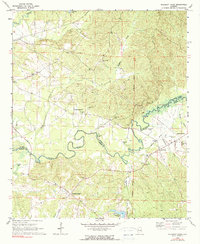
Other maps of this area

1927 · Eutaw
USGS Topo · 1:48,000

1931 · Eutaw
USGS Topo · 1:62,500

1953 · Montgomery
USGS Topo · 1:250,000

1953 · Birmingham
USGS Topo · 1:250,000

1953 · Meridian
USGS Topo · 1:250,000

1953 · West Point
USGS Topo · 1:250,000

1956 · Birmingham
USGS Topo · 1:250,000

1956 · Montgomery
USGS Topo · 1:250,000

1957 · Birmingham
USGS Topo · 1:250,000

1957 · Meridian
USGS Topo · 1:250,000