
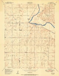
1950 Map of Alida
USGS Topo · Published 1950About this map
The Republican River meanders through the northeast corner of this landscape, flanked by the Union Pacific railroad and the rural community of Alida. This mid-century survey captures a classic Kansas agricultural setting defined by a network of rural school districts and family cemeteries that anchored early settlement. Features such as the Alida School, Tell School, and Good Hope School District 42 reveal the localized structure of education before district consolidation. The topography transitions from the alluvial plains of the river valley toward the prominent elevations of Fragrant Hill and Smoky Hill to the south. Local landmarks like Ritter Airport and various reservoirs illustrate the early post-war development of infrastructure and water management across the Dickinson and Geary County line.
Find a feature on this map
25 named features on this map. Tap any name to fly to it.
Don’t see what you’re looking for? This feature index may not catch every label — zoom into the map to look around manually.
Map Details
Editions of this 1950 Alida Map
2 editions found
Other maps of this area

1886 · Junction City
USGS Topo · 1:125,000

1889 · Junction City
USGS Topo · 1:125,000

1889 · Abilene
USGS Topo · 1:125,000

1889 · Parkerville
USGS Topo · 1:125,000

1891 · Clay Center
USGS Topo · 1:125,000

1894 · Junction City
USGS Topo · 1:125,000

1894 · Abilene
USGS Topo · 1:125,000

1894 · Parkerville
USGS Topo · 1:125,000

1947 · Fort Riley
USGS Topo · 1:62,500

1950 · Junction City
USGS Topo · 1:24,000