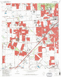
1982 Map of Alief
USGS Topo · Published 1982About this map
The rapid expansion of West Houston into formerly agricultural lands defines this early 1980s landscape. Suburban growth is visible in the dense networks of residential streets pushing toward Alief, Stafford, and Sugar Land. Significant institutional presence is established here, including Houston Baptist University, St Agnes Academy, and Strake Jesuit College Prep High Sch. The region is drained by the meandering courses of Brays Bayou and Keegans Bayou, which remain prominent natural features amidst the encroaching grid.
Find a feature on this map
58 named features on this map. Tap any name to fly to it.
Don’t see what you’re looking for? This feature index may not catch every label — zoom into the map to look around manually.
Map Details
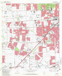
Editions of this 1982 Alief Map
2 editions found
Other maps of this area

1915 · Bellaire
USGS Topo · 1:24,000

1915 · Houston Heights
USGS Topo · 1:24,000

1915 · Alief
USGS Topo · 1:24,000

1915 · Addicks
USGS Topo · 1:24,000

1915 · Hillendahl
USGS Topo · 1:24,000

1915 · Clodine
USGS Topo · 1:24,000

1918 · Addicks
USGS Topo · 1:31,680

1918 · Hillendahl
USGS Topo · 1:31,680

1919 · Clodine
USGS Topo · 1:31,680

1920 · Almeda
USGS Topo · 1:31,680