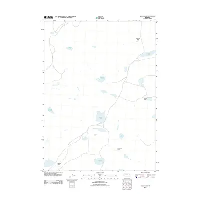
2011 Map of Alkali Lake
USGS Topo · Published 2011About this map
Alkali Lake serves as a central landmark in this portion of Garden County, where a cluster of freshwater and alkaline basins dot the Nebraska Sandhills. The landscape is defined by its closed depressions and distinct valleys, including Round Valley and Ballinger Valley, which reveal the region's unique hydrologic character. A network of rural routes such as Abbott Rd and Road 209 connect the scattered water bodies, which range from the northern Potter Lake and Dominick Lake to Groves Lake in the south. The placement of Dipping Vat Lake suggests the local importance of livestock and ranching infrastructure within this specialized environment. These named landmarks and valleys indicate a long-standing system of land use where family-named features like Kramer Valley and Kirkpatrick Valley anchor the geography.
Find a feature on this map
17 named features on this map. Tap any name to fly to it.
Don’t see what you’re looking for? This feature index may not catch every label — zoom into the map to look around manually.
Map Details
Editions of this 2011 Alkali Lake Map
This is the sole edition of this map. No revisions or reprints were ever made.
Other maps of this area

1948 · Ashby
USGS Topo · 1:62,500

1948 · Bingham
USGS Topo · 1:62,500

1948 · George Lake
USGS Topo · 1:62,500

1949 · Ashby
USGS Topo · 1:62,500

1950 · George Lake
USGS Topo · 1:62,500

1950 · Longfellow Lake
USGS Topo · 1:62,500

1950 · Bingham
USGS Topo · 1:62,500

1954 · Scottsbluff
USGS Topo · 1:250,000

1954 · North Platte
USGS Topo · 1:250,000

1955 · Alliance
USGS Topo · 1:250,000