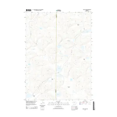
2014 Map of Alkali Lake
USGS Topo · Published 2014About this map
Alkali Lake sits at the heart of this Sandhills landscape, marking a terrain defined by internal drainage and high-desert hydrology. The 2014 survey reveals a cluster of distinct water bodies, including Longfellow Lake, Potter Lake, and the curiously named Dipping Vat Lake, scattered across the undulating dunes. These lakes are the primary landmarks in a region largely devoid of conventional settlements, where the geography is instead defined by broad basins like Diamond Valley, Ballinger Valley, and Round Valley. The network of local routes, such as Bingham Rd and Abbott Rd, traces the path of least resistance through the hills, connecting these disparate water sources. The map provides a precise look at the rural infrastructure of Garden County and Grant County, where the placement of named valleys and isolated lakes reflects the long-standing ranching history of the Nebraska Panhandle.
Find a feature on this map
22 named features on this map. Tap any name to fly to it.
Don’t see what you’re looking for? This feature index may not catch every label — zoom into the map to look around manually.
Map Details
Editions of this 2014 Alkali Lake Map
This is the sole edition of this map. No revisions or reprints were ever made.
Other maps of this area

1948 · Ashby
USGS Topo · 1:62,500

1948 · Bingham
USGS Topo · 1:62,500

1948 · George Lake
USGS Topo · 1:62,500

1949 · Ashby
USGS Topo · 1:62,500

1950 · George Lake
USGS Topo · 1:62,500

1950 · Longfellow Lake
USGS Topo · 1:62,500

1950 · Bingham
USGS Topo · 1:62,500

1954 · Scottsbluff
USGS Topo · 1:250,000

1954 · North Platte
USGS Topo · 1:250,000

1955 · Alliance
USGS Topo · 1:250,000