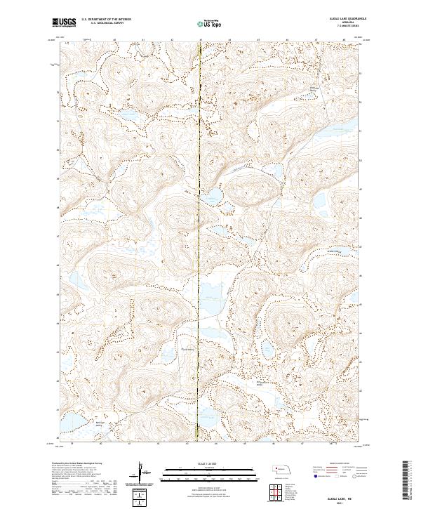
2021 Map of Alkali Lake
USGS Topo · Published 2021About this map
Alkali Lake lies at the center of this hydrographic landscape in the Nebraska Sandhills, straddling the county line between Garden and Grant Counties. The terrain is defined by a repetitive pattern of interdunal basins, where water collects in numerous small bodies such as Potter Lake, Longfellow Lake, and Groves Lake. This 2021 survey illustrates how the local road network, including Bingham Rd and Abbott Rd, navigates the complex topography of the region.
Find a feature on this map
21 named features on this map. Tap any name to fly to it.
Don’t see what you’re looking for? This feature index may not catch every label — zoom into the map to look around manually.
Map Details
Editions of this 2021 Alkali Lake Map
This is the sole edition of this map. No revisions or reprints were ever made.
Other maps of this area

1948 · Ashby
USGS Topo · 1:62,500

1948 · Bingham
USGS Topo · 1:62,500

1948 · George Lake
USGS Topo · 1:62,500

1949 · Ashby
USGS Topo · 1:62,500

1950 · George Lake
USGS Topo · 1:62,500

1950 · Longfellow Lake
USGS Topo · 1:62,500

1950 · Bingham
USGS Topo · 1:62,500

1954 · Scottsbluff
USGS Topo · 1:250,000

1954 · North Platte
USGS Topo · 1:250,000

1955 · Alliance
USGS Topo · 1:250,000