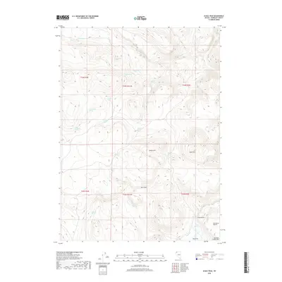
2018 Map of Alkali Peak
USGS Topo · Published 2018About this map
Alkali Peak dominates this high-elevation landscape in Humboldt County, where an intricate network of springs and intermittent creeks defines the local geography. The presence of numerous named water sources, such as Chokecherry Spring, Mcclusky Spring, and Big Buckaroo Spring, points to a history of ranching and livestock management in this arid territory. The terrain transitions from the steep elevations of Devaney Mtn down into the Virgin Valley, eventually reaching the low-lying Alkali Flat. To the southeast, the Alkali Reservoir sits near the Wild Horse Pasture, indicating how the land has been utilized for grazing. The complex drainage systems, including Hell Cr and the narrow passage of Box Canyon, illustrate the erosive forces that have shaped these High Rock Canyon Hills.
Find a feature on this map
32 named features on this map. Tap any name to fly to it.
Don’t see what you’re looking for? This feature index may not catch every label — zoom into the map to look around manually.
Map Details
Editions of this 2018 Alkali Peak Map
This is the sole edition of this map. No revisions or reprints were ever made.
Other maps of this area

1889 · Long Valley
USGS Topo · 1:250,000

1954 · Vya
USGS Topo · 1:250,000

1958 · Vya
USGS Topo · 1:250,000

1962 · Vya
USGS Topo · 1:250,000

1965 · Rock Spring Table
USGS Topo · 1:62,500

1966 · Big Spring Butte
USGS Topo · 1:62,500

1966 · Blowout Mtn
USGS Topo · 1:24,000

1966 · Badger Mtn SE
USGS Topo · 1:24,000
1966 · Catnip Mtn. SE
USGS Topo · 1:24,000
1987 · Vya
USGS Topo · 1:100,000