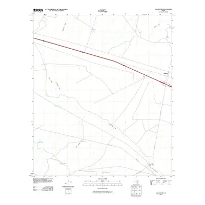
2010 Map of Allamoore
USGS Topo · Published 2010About this map
The settlement of Allamoore sits along a critical transportation corridor in West Texas, where the modern interstate and the Southern Pacific Rd parallel one another across a terrain defined by desert drainage patterns. This high-desert landscape in Hudspeth County is characterized by numerous water catchments essential for ranching, such as Jim Bean Tank, Stage Road Tank, and Williams Tank. These tanks and the presence of Hot Wells near the railroad tracks indicate the vital importance of water management in this arid environment. Ranching interests are well-represented by named sites like Dees Ranch and Booth Ranch, situated near the Millican Hills. The map also captures the intricate network of seasonal watercourses, including Seventeen Draw and Eagle Flat Draw, which dictate the local topography and the placement of remote routes like Green Gap Rd.
Find a feature on this map
22 named features on this map. Tap any name to fly to it.
Don’t see what you’re looking for? This feature index may not catch every label — zoom into the map to look around manually.
Map Details
Editions of this 2010 Allamoore Map
This is the sole edition of this map. No revisions or reprints were ever made.
Other maps of this area

1892 · Chispa
USGS Topo · 1:125,000

1895 · Chispa
USGS Topo · 1:125,000

1895 · Sierra Blanca
USGS Topo · 1:125,000

1897 · Eagle Mountain
USGS Topo · 1:125,000

1897 · Chispa
USGS Topo · 1:125,000

1906 · Van Horn
USGS Topo · 1:125,000

1916 · Eagle Mountain
USGS Topo · 1:125,000

1954 · Van Horn
USGS Topo · 1:250,000

1958 · Van Horn
USGS Topo · 1:250,000

1959 · Marfa
USGS Topo · 1:250,000