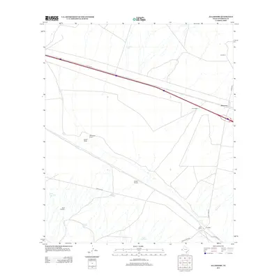
2012 Map of Allamoore
USGS Topo · Published 2012About this map
Allamoore sits along the northern transportation corridor of this Hudspeth County landscape, characterized by an intricate network of arroyos, draws, and canyon systems. The arid terrain is marked by essential water management features such as Jim Bean Tank, Silva Tank, and Stage Road Tank, which supported the region's ranching operations. The mapping of Booth Ranch, Dees Ranch, and Espy Ranch provides a clear view of land use and property divisions in the early 21st century. Further south, the settlement at Hot Wells and the drainage of Mineral Cr indicate historical points of activity away from the primary highway. Notable landforms like Goat Canyon and the winding Carral Arroyo illustrate the complex drainage patterns of the Trans-Pecos region, where seasonal water flow has carved distinct paths through the desert floor near Camel Draw.
Find a feature on this map
24 named features on this map. Tap any name to fly to it.
Don’t see what you’re looking for? This feature index may not catch every label — zoom into the map to look around manually.
Map Details
Editions of this 2012 Allamoore Map
This is the sole edition of this map. No revisions or reprints were ever made.
Other maps of this area

1892 · Chispa
USGS Topo · 1:125,000

1895 · Chispa
USGS Topo · 1:125,000

1895 · Sierra Blanca
USGS Topo · 1:125,000

1897 · Eagle Mountain
USGS Topo · 1:125,000

1897 · Chispa
USGS Topo · 1:125,000

1906 · Van Horn
USGS Topo · 1:125,000

1916 · Eagle Mountain
USGS Topo · 1:125,000

1954 · Van Horn
USGS Topo · 1:250,000

1958 · Van Horn
USGS Topo · 1:250,000

1959 · Marfa
USGS Topo · 1:250,000