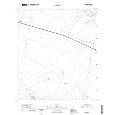
2019 Map of Allamoore
USGS Topo · Published 2019About this map
The arid high-desert landscape of Eagle Flat dominates this section of Hudspeth County, where the infrastructure of ranching and transportation adapts to the basin-and-range topography. Water management is the primary human imprint on the land, evidenced by a dense network of catchments such as Jim Bean Tank, Silva Tank, and Horse Trap Tank that support livestock across the open range. These tanks are strategically placed near natural drainages like Seventeen Draw and Eagle Flat Draw, which channel intermittent runoff from the surrounding high ground.
Find a feature on this map
21 named features on this map. Tap any name to fly to it.
Don’t see what you’re looking for? This feature index may not catch every label — zoom into the map to look around manually.
Map Details
Editions of this 2019 Allamoore Map
This is the sole edition of this map. No revisions or reprints were ever made.
Other maps of this area

1892 · Chispa
USGS Topo · 1:125,000

1895 · Chispa
USGS Topo · 1:125,000

1895 · Sierra Blanca
USGS Topo · 1:125,000

1897 · Eagle Mountain
USGS Topo · 1:125,000

1897 · Chispa
USGS Topo · 1:125,000

1906 · Van Horn
USGS Topo · 1:125,000

1916 · Eagle Mountain
USGS Topo · 1:125,000

1954 · Van Horn
USGS Topo · 1:250,000

1958 · Van Horn
USGS Topo · 1:250,000

1959 · Marfa
USGS Topo · 1:250,000