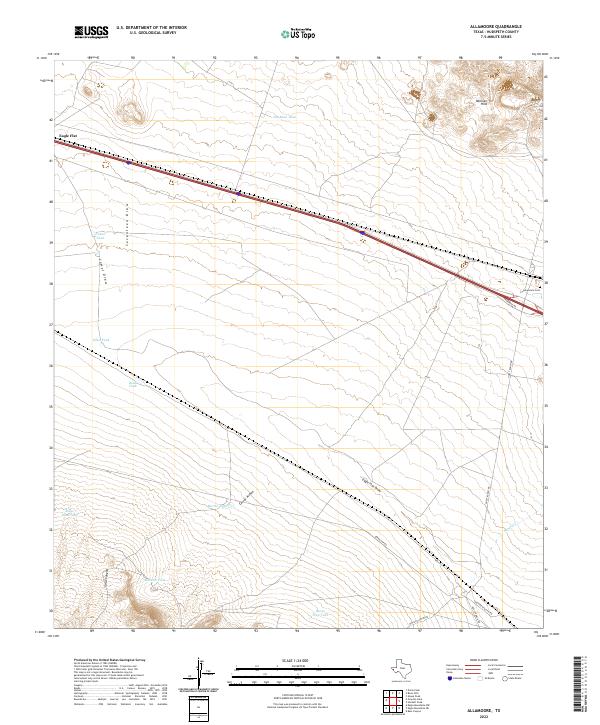
2022 Map of Allamoore
USGS Topo · Published 2022About this map
Allamoore Cem sits at the eastern edge of a high desert landscape dominated by drainage networks and livestock infrastructure. The terrain is defined by the broad expanse of Eagle Flat and the rising elevations of the Millican Hills to the northeast. Transportation corridors are central to the layout of the area, with the Southern Pacific Rd and various ranch roads like Guest Ranch Rd cutting through the arid territory.
Find a feature on this map
22 named features on this map. Tap any name to fly to it.
Don’t see what you’re looking for? This feature index may not catch every label — zoom into the map to look around manually.
Map Details
Editions of this 2022 Allamoore Map
This is the sole edition of this map. No revisions or reprints were ever made.
Other maps of this area

1892 · Chispa
USGS Topo · 1:125,000

1895 · Chispa
USGS Topo · 1:125,000

1895 · Sierra Blanca
USGS Topo · 1:125,000

1897 · Eagle Mountain
USGS Topo · 1:125,000

1897 · Chispa
USGS Topo · 1:125,000

1906 · Van Horn
USGS Topo · 1:125,000

1916 · Eagle Mountain
USGS Topo · 1:125,000

1954 · Van Horn
USGS Topo · 1:250,000

1958 · Van Horn
USGS Topo · 1:250,000

1959 · Marfa
USGS Topo · 1:250,000