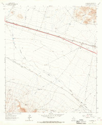
1964 Map of Allamoore
USGS Topo · Published 1967About this map
The Old Spanish Trail and the parallel tracks of the Southern Pacific and Texas and Pacific railroads define this West Texas landscape in the mid-1960s. Settled pockets like Allamoore and Hot Wells anchor the transport corridor through Hudspeth County, where the geography is dominated by the broad drainage of Eagle Flat and Seventeen Draw. The map reveals a ranching economy reliant on isolated water sources, including Williams Tank, Silva Tank, and Stage Road Tank, which supported livestock across the arid terrain.
Find a feature on this map
36 named features on this map. Tap any name to fly to it.
Don’t see what you’re looking for? This feature index may not catch every label — zoom into the map to look around manually.
Map Details
Editions of this 1964 Allamoore Map
This is the sole edition of this map. No revisions or reprints were ever made.
Other maps of this area

1892 · Chispa
USGS Topo · 1:125,000

1895 · Chispa
USGS Topo · 1:125,000

1895 · Sierra Blanca
USGS Topo · 1:125,000

1897 · Eagle Mountain
USGS Topo · 1:125,000

1897 · Chispa
USGS Topo · 1:125,000

1906 · Van Horn
USGS Topo · 1:125,000

1916 · Eagle Mountain
USGS Topo · 1:125,000

1954 · Van Horn
USGS Topo · 1:250,000

1958 · Van Horn
USGS Topo · 1:250,000

1959 · Marfa
USGS Topo · 1:250,000