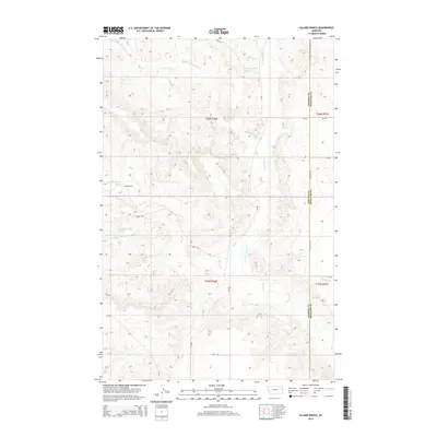
2014 Map of Allard Ranch
USGS Topo · Published 2014About this map
Allard Ranch serves as the primary landmark in this ranching landscape within Richland County and Dawson County. The terrain is defined by an intricate network of drainages, including Middle Fork Burns Cr and N Fork Burns Cr, which converge into the main channel of Burns Cr. These seasonal waterways are supported by numerous identified springs, such as 20N56E32CABC01 Spring and 19N56E05BABA Spring, which were vital for sustaining livestock in this arid environment. The map details a grid of local infrastructure like Co Road 334 and Road 530 that follows section lines across the high plains, illustrating the intersection of natural hydrology and the Public Land Survey System. Further south, Beef Slough provides additional drainage in the complex topography of the T19N and T20N ranges.
Find a feature on this map
25 named features on this map. Tap any name to fly to it.
Don’t see what you’re looking for? This feature index may not catch every label — zoom into the map to look around manually.
Map Details
Editions of this 2014 Allard Ranch Map
This is the sole edition of this map. No revisions or reprints were ever made.
Other maps of this area

1909 · Glendive
USGS Topo · 1:250,000

1954 · Glendive
USGS Topo · 1:250,000

1957 · Glendive
USGS Topo · 1:250,000

1958 · Glendive
USGS Topo · 1:250,000

1966 · Kolberg Ranch
USGS Topo · 1:24,000

1966 · Savage SW
USGS Topo · 1:24,000

1966 · Intake
USGS Topo · 1:24,000

1966 · Knife River Mine
USGS Topo · 1:24,000

1966 · Intake NW
USGS Topo · 1:24,000

1966 · Allard Ranch
USGS Topo · 1:24,000