
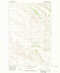
1966 Map of Intake NW
USGS Topo · Published 1970About this map
Burns Creek and Thirteenmile Creek carve through this section of Dawson County, Montana, during a period of steady ranching and rural activity in the mid-1960s. The landscape is defined by its wide, dissected drainage basins and the essential community nodes that served local families. Educational landmarks like Pleasant Plains Sch and East Pleasant Plains Sch are clearly marked, alongside the Lutheran Ch and its accompanying Lutheran Ch Cem. These sites, along with a prominent Gravel Pit, reflect a period before significant modern consolidation, preserving the locations of the social and economic infrastructure that supported the remote homesteads of the Missouri River Basin development area.
Find a feature on this map
9 named features on this map. Tap any name to fly to it.
Don’t see what you’re looking for? This feature index may not catch every label — zoom into the map to look around manually.
Map Details
Editions of this 1966 Intake NW Map
2 editions found
Other maps of this area

1909 · Glendive
USGS Topo · 1:250,000

1954 · Glendive
USGS Topo · 1:250,000

1957 · Glendive
USGS Topo · 1:250,000

1958 · Glendive
USGS Topo · 1:250,000

1966 · Kolberg Ranch
USGS Topo · 1:24,000

1966 · Intake
USGS Topo · 1:24,000

1966 · Allard Ranch
USGS Topo · 1:24,000

1972 · Red Top
USGS Topo · 1:24,000

1972 · Butler Table
USGS Topo · 1:24,000

1972 · Morgan Creek School
USGS Topo · 1:24,000