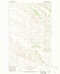
1966 Map of Intake NW
USGS Topo · Published 1970About this map
Burns Creek and its complex network of seasonal drainage channels define the topography of this Dawson County landscape during the mid-1960s. The map illustrates a rural settlement pattern centered on community education and faith, evidenced by the presence of the Pleasant Plains Sch and the East Pleasant Plains Sch. These schools, spaced across the wide terrain, reveal the distances traveled by ranching families before the consolidation of rural school districts. A central Lutheran Ch and adjacent Cem serve as the primary social and spiritual landmarks for the surrounding homesteads. Industrial activity is minimal but present, noted by a Gravel Pit near the center of the sheet. To the south, Thirteenmile Creek cuts through the plains, while various Spring labels indicate the vital water sources required for livestock and survival in this semi-arid region.
Find a feature on this map
10 named features on this map. Tap any name to fly to it.
Don’t see what you’re looking for? This feature index may not catch every label — zoom into the map to look around manually.
Map Details
Editions of this 1966 Intake NW Map
2 editions found
Other maps of this area

1909 · Glendive
USGS Topo · 1:250,000

1954 · Glendive
USGS Topo · 1:250,000

1957 · Glendive
USGS Topo · 1:250,000

1958 · Glendive
USGS Topo · 1:250,000

1966 · Kolberg Ranch
USGS Topo · 1:24,000

1966 · Intake
USGS Topo · 1:24,000

1966 · Intake NW
USGS Topo · 1:24,000

1966 · Allard Ranch
USGS Topo · 1:24,000

1972 · Red Top
USGS Topo · 1:24,000

1972 · Butler Table
USGS Topo · 1:24,000