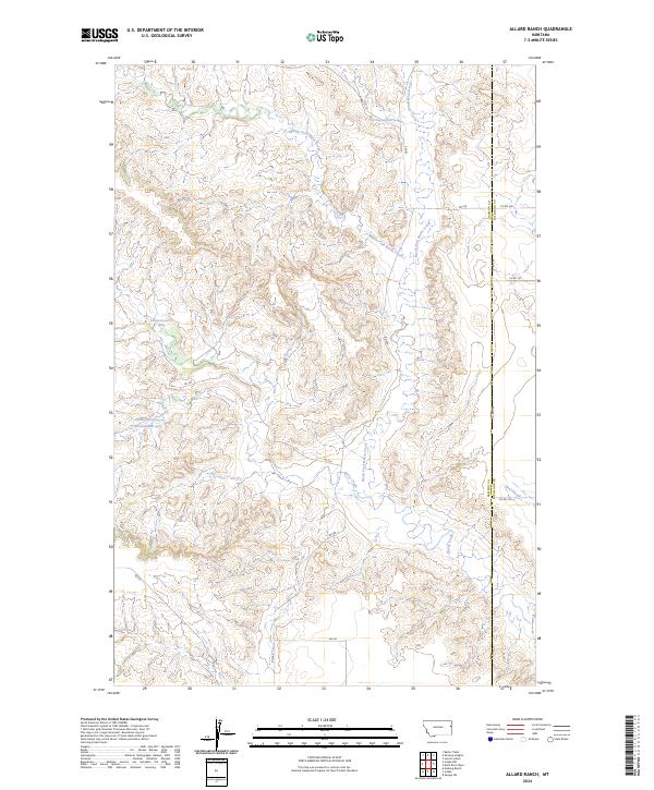
2024 Map of Allard Ranch
USGS Topo · Published 2024About this map
Burns Creek and its complex network of tributaries, including the North Fork Burns Creek and Middle Fork Burns Creek, define the drainage patterns across this section of the Montana prairie. This landscape, situated along the border of Dawson and Richland Counties, is characterized by dissected terrain where water sources are critical to the local geography. Several numbered springs, such as 19N56E08BBBB01 Spring and 20N56E14CDBA01 Spring, are precisely documented, reflecting the importance of groundwater in this semi-arid region. The presence of Beef Slough in the southeast corner further illustrates the intricate hydraulic network that has shaped land use and property boundaries since the original Public Land Survey System was established. The map provides a detailed view of the section lines and local transit routes like RD 530 and Co RD 344 that connect these remote ranchlands.
Find a feature on this map
23 named features on this map. Tap any name to fly to it.
Don’t see what you’re looking for? This feature index may not catch every label — zoom into the map to look around manually.
Map Details
Editions of this 2024 Allard Ranch Map
This is the sole edition of this map. No revisions or reprints were ever made.
Other maps of this area

1909 · Glendive
USGS Topo · 1:250,000

1954 · Glendive
USGS Topo · 1:250,000

1957 · Glendive
USGS Topo · 1:250,000

1958 · Glendive
USGS Topo · 1:250,000

1966 · Kolberg Ranch
USGS Topo · 1:24,000

1966 · Savage SW
USGS Topo · 1:24,000

1966 · Intake
USGS Topo · 1:24,000

1966 · Knife River Mine
USGS Topo · 1:24,000

1966 · Intake NW
USGS Topo · 1:24,000

1966 · Allard Ranch
USGS Topo · 1:24,000