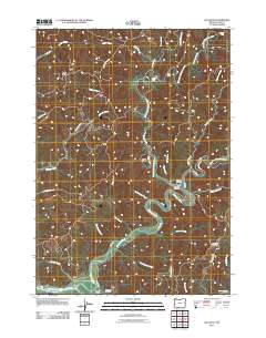
2011 Map of Allegany
USGS Topo · Published 2011About this map
The settlement of Allegany sits at the vital confluence where the West Fork Millicoma River and East Fork Millicoma River merge to form the main stem of the Millicoma River. This 2011 survey captures a landscape defined by its complex drainage systems and timber-related infrastructure, with names like Weyerhaeuser Ln and Marlow Creek Rd tracing the winding valleys. Local genealogy is anchored by the Allegany Cemetery and the Allegany Post Office, while further south, the South Fork Cemetery lies near the Landrith Bridge spanning the Millicoma River. The terrain is marked by significant elevation changes, from the heights of McKeever Mountain and Baldy Butte to the river's edge at Devils Elbow. Numerous water features, including Henrys Falls, Estell Falls, and Pidgeon Falls, suggest the steep, stepped character of the drainage basins flowing toward the Coos River system.
Find a feature on this map
52 named features on this map. Tap any name to fly to it.
Don’t see what you’re looking for? This feature index may not catch every label — zoom into the map to look around manually.
Map Details
Editions of this 2011 Allegany Map
This is the sole edition of this map. No revisions or reprints were ever made.
Other maps of this area

1896 · Coos Bay
USGS Topo · 1:125,000

1898 · Coos Bay
USGS Topo · 1:125,000

1900 · Coos Bay
USGS Topo · 1:125,000

1923 · Reedsport
USGS Topo · 1:62,500

1928 · Sitkum
USGS Topo · 1:125,000

1942 · Reedsport
USGS Topo · 1:62,500

1942 · Coos Bay
USGS Topo · 1:62,500

1945 · Coos Bay
USGS Topo · 1:62,500

1954 · Coos Bay
USGS Topo · 1:250,000

1955 · Scottsburg
USGS Topo · 1:62,500