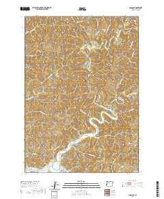
2020 Map of Allegany
USGS Topo · Published 2020About this map
The confluence of the West Fork Millicoma River and the East Fork Millicoma River anchors the community of Allegany, where the river systems unite to form the Millicoma River. This 2020 survey details a landscape defined by its waterways and steep coastal terrain, featuring notable landmarks like Baldy Butte and McKeever Mtn. The river valleys are the primary corridors for settlement and transport, evidenced by the Coos River Hwy 241 following the southern banks. Genealogy and local history researchers can identify established sites such as the Allegany Cem and South Fork Cem, while the interior remains defined by its natural drainage, including numerous cascades such as Pidgeon Falls, Estelle Falls, and Henry Falls. The curiously named Wee House Hole sits along the southern edge of the quadrangle near Bridges Cr, suggesting localized landmarks known to residents of the Coos River basin.
Find a feature on this map
56 named features on this map. Tap any name to fly to it.
Don’t see what you’re looking for? This feature index may not catch every label — zoom into the map to look around manually.
Map Details
Editions of this 2020 Allegany Map
This is the sole edition of this map. No revisions or reprints were ever made.
Other maps of this area

1896 · Coos Bay
USGS Topo · 1:125,000

1898 · Coos Bay
USGS Topo · 1:125,000

1900 · Coos Bay
USGS Topo · 1:125,000

1923 · Reedsport
USGS Topo · 1:62,500

1928 · Sitkum
USGS Topo · 1:125,000

1942 · Reedsport
USGS Topo · 1:62,500

1942 · Coos Bay
USGS Topo · 1:62,500

1945 · Coos Bay
USGS Topo · 1:62,500

1954 · Coos Bay
USGS Topo · 1:250,000

1955 · Scottsburg
USGS Topo · 1:62,500