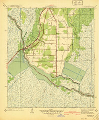
1940 Map of Allemands
USGS Topo · Published 1940About this map
The low-lying wetlands of St Charles Parish and Lafourche Parish are defined here by a dense network of reclamation canals and bayous surveyed just before the 1940s. The settlement of Allemands and the Des Allemands Sta serve as the primary hubs, situated where the Southern Pacific railroad crosses the wide Bayou Des Allemands. This preliminary survey highlights a landscape in transition, where natural waterways like Bayou Crocodile and Grand Bayou are supplemented by a numbered grid of drainage projects, including Canal No 13 and Canal No 18, likely intended for agricultural expansion. Local life centers on the rail line and small outposts like Vallier and the St Charles Sch, while the surrounding marsh is dotted with islands such as Victor Island and the evocatively named Ile Du Prince Noir.
Find a feature on this map
50 named features on this map. Tap any name to fly to it.
Don’t see what you’re looking for? This feature index may not catch every label — zoom into the map to look around manually.
Map Details
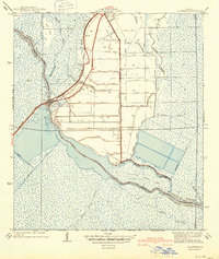
Editions of this 1940 Allemands Map
2 editions found
Other maps of this area

1891 · Hahnville
USGS Topo · 1:62,500

1892 · Lac Des Allemands
USGS Topo · 1:62,500

1892 · Cut-Off
USGS Topo · 1:62,500

1892 · Houma
USGS Topo · 1:62,500

1932 · Lac Des Allemands SE
USGS Topo · 1:31,680

1932 · Houma NE
USGS Topo · 1:31,680

1932 · Hahnville NW
USGS Topo · 1:31,680

1932 · Lac Des Allemands NE
USGS Topo · 1:31,680

1932 · Hahnville SW
USGS Topo · 1:31,680

1932 · Hahnville NE
USGS Topo · 1:31,680