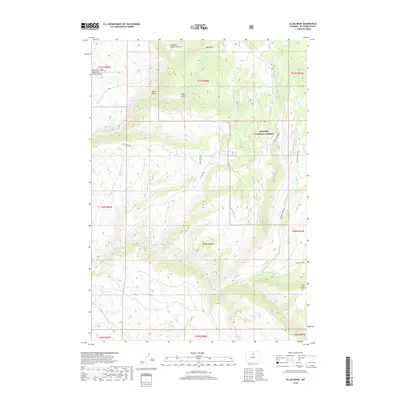
2018 Map of Allen Draw
USGS Topo · Published 2018About this map
Bighorn National Forest dominates the eastern landscape of this Big Horn County region, where the high-elevation terrain is carved by complex drainage systems. The northern reaches are defined by the deep incision of Medicine Lodge Canyon and the prominent rising of Bear Mtn, while the western edge contains the Medicine Lodge Big-Game Winter Range, highlighting the area's importance for wildlife management. The hydrological network is particularly intricate here, with Medicine Lodge Cr and Captain Jack Cr flowing through the northwestern canyons. To the south, the terrain levels slightly near the confluence-bound waters of Middle Paint Rock Cr and Liddle Cr, showcasing a transition from mountain forest to high-desert gulches and draws like Allen Draw and Deer Gulch.
Find a feature on this map
28 named features on this map. Tap any name to fly to it.
Don’t see what you’re looking for? This feature index may not catch every label — zoom into the map to look around manually.
Map Details
Editions of this 2018 Allen Draw Map
This is the sole edition of this map. No revisions or reprints were ever made.
Other maps of this area

1899 · Cloud peak
USGS Topo · 1:125,000

1901 · Cloud Peak
USGS Topo · 1:125,000

1955 · Sheridan
USGS Topo · 1:250,000

1958 · Sheridan
USGS Topo · 1:250,000

1960 · Shell Lake
USGS Topo · 1:24,000

1960 · Lake Solitude
USGS Topo · 1:24,000

1960 · Spanish Point
USGS Topo · 1:24,000

1960 · Hyatt Ranch
USGS Topo · 1:24,000
1960 · Bush Butte
USGS Topo · 1:24,000

1962 · Sheridan
USGS Topo · 1:250,000