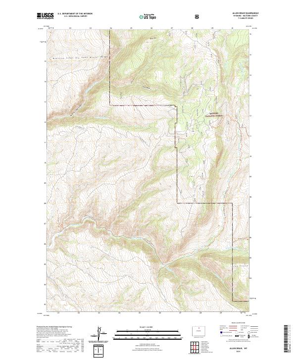
2021 Map of Allen Draw
USGS Topo · Published 2021About this map
The Medicine Lodge Big Game Winter Range and the western edge of the Bighorn National Forest dominate this landscape in Big Horn County. The topography is defined by significant elevation changes, particularly around Bear Mtn and the deep cuts of Medicine Lodge Canyon. This area is characterized by its complex drainage network, where Medicine Lodge Cr and Paint Rock Cr carve through the high country.
Find a feature on this map
32 named features on this map. Tap any name to fly to it.
Don’t see what you’re looking for? This feature index may not catch every label — zoom into the map to look around manually.
Map Details
Editions of this 2021 Allen Draw Map
This is the sole edition of this map. No revisions or reprints were ever made.
Other maps of this area

1899 · Cloud peak
USGS Topo · 1:125,000

1901 · Cloud Peak
USGS Topo · 1:125,000

1955 · Sheridan
USGS Topo · 1:250,000

1958 · Sheridan
USGS Topo · 1:250,000

1960 · Shell Lake
USGS Topo · 1:24,000

1960 · Lake Solitude
USGS Topo · 1:24,000

1960 · Spanish Point
USGS Topo · 1:24,000

1960 · Hyatt Ranch
USGS Topo · 1:24,000
1960 · Bush Butte
USGS Topo · 1:24,000

1962 · Sheridan
USGS Topo · 1:250,000