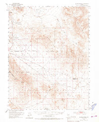
1951 Map of Allen Springs
USGS Topo · Published 1967About this map
The Cocoon Mountains and the Blow Sand Mountains dominate this arid Churchill County landscape as it appeared in the early 1950s. This survey area is defined by its extreme water scarcity, noted by the presence of Stinking Springs (Undrinkable) and the distant Allen Springs and Lee Hot Springs. The map reveals a transition from traditional mining activities at the Pyramid Mine and Black Butte Mine to mid-century military land use, with a large central swath designated as a Naval Reservation.
Find a feature on this map
28 named features on this map. Tap any name to fly to it.
Don’t see what you’re looking for? This feature index may not catch every label — zoom into the map to look around manually.
Map Details
Editions of this 1951 Allen Springs Map
3 editions found
Other maps of this area

1908 · Carson Sink
USGS Topo · 1:250,000

1909 · Hawthorne
USGS Topo · 1:250,000

1910 · Carson Sink
USGS Topo · 1:250,000

1911 · Hawthorne
USGS Topo · 1:250,000

1915 · Hawthorne
USGS Topo · 1:250,000

1948 · Walker Lake
USGS Topo · 1:250,000

1951 · Carson Lake
USGS Topo · 1:62,500

1951 · Allen Springs
USGS Topo · 1:62,500

1951 · Weber Reservoir
USGS Topo · 1:62,500

1951 · Fallon
USGS Topo · 1:62,500