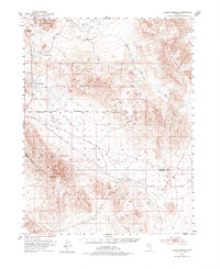
1951 Map of Allen Springs
USGS Topo · Published 1977About this map
Allen Springs and the surrounding desert basins of Churchill County appear here as documented in a 1951 survey. This arid landscape is defined by its extreme hydrology and remote outposts, featuring the curiously labeled Stinking Springs and the expansive Alkali Flat. The map reveals a history of resource extraction and strategic land use, shown through the boundaries of the Naval Reservation and the Walker River Indian Reservation.
Find a feature on this map
27 named features on this map. Tap any name to fly to it.
Don’t see what you’re looking for? This feature index may not catch every label — zoom into the map to look around manually.
Map Details
Editions of this 1951 Allen Springs Map
3 editions found
Other maps of this area

1908 · Carson Sink
USGS Topo · 1:250,000

1909 · Hawthorne
USGS Topo · 1:250,000

1910 · Carson Sink
USGS Topo · 1:250,000

1911 · Hawthorne
USGS Topo · 1:250,000

1915 · Hawthorne
USGS Topo · 1:250,000

1948 · Walker Lake
USGS Topo · 1:250,000

1951 · Carson Lake
USGS Topo · 1:62,500

1951 · Allen Springs
USGS Topo · 1:62,500

1951 · Weber Reservoir
USGS Topo · 1:62,500

1951 · Fallon
USGS Topo · 1:62,500