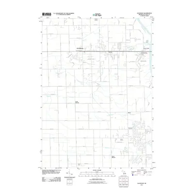
2011 Map of Allendale
USGS Topo · Published 2011About this map
Allendale and the Grand Valley State University-Allendale Campus anchor this portion of Ottawa County, where the landscape transitions from established academic and residential hubs to a grid of agricultural lands and smaller rural settlements. The Grand River defines the eastern boundary, accompanied by the Little Mac Bridge and the rising development of Grand Valley. Moving south, the terrain is shaped by the drainage systems of Bass Creek and Rush Creek, which flow toward the more isolated communities of North Blendon, South Blendon, and Bauer. Genealogists and local historians will find the Allendale Township Cemetery and Blendon Cemetery clearly marked, alongside essential civic landmarks like the Allendale Post Office. The map reflects a period of modern growth in West Michigan, where suburban expansion meets long-standing farming districts.
Find a feature on this map
71 named features on this map. Tap any name to fly to it.
Don’t see what you’re looking for? This feature index may not catch every label — zoom into the map to look around manually.
Map Details
Editions of this 2011 Allendale Map
This is the sole edition of this map. No revisions or reprints were ever made.
Other maps of this area

1929 · Holland
USGS Topo · 1:62,500

1930 · Muskegon
USGS Topo · 1:62,500

1932 · Holland
USGS Topo · 1:62,500

1936 · Muskegon
USGS Topo · 1:62,500

1945 · Ravenna
USGS Topo · 1:62,500

1954 · Milwaukee
USGS Topo · 1:250,000

1954 · Midland
USGS Topo · 1:250,000

1958 · Midland
USGS Topo · 1:250,000

1958 · Milwaukee
USGS Topo · 1:250,000

1958 · Allendale
USGS Topo · 1:24,000