
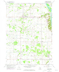
1958 Map of Allendale
USGS Topo · Published 1959About this map
The Grand River carves a sharp bluff along the eastern edge of this late 1950s Ottawa County landscape, where the agricultural plateaus of Allendale and Blendon townships are deeply incised by the drainage of Bass Creek. The settlement of Allendale serves as a central hub, surrounded by a grid of rural schoolhouses and churches that anchored the farming community. Genealogy researchers can locate family-named landmarks such as White Sch No 2, Star Sch No 3, and Corwin Sch No 3, alongside the Township Cem and Blendon Cem. Small rural centers like Pearline, North Blendon, and Bauer appear as modest clusters of buildings, while numerous Gravel Pits scattered across the township suggest the local extractive industries that supported regional road development during this era of growth.
Find a feature on this map
23 named features on this map. Tap any name to fly to it.
Don’t see what you’re looking for? This feature index may not catch every label — zoom into the map to look around manually.
Map Details
Editions of this 1958 Allendale Map
2 editions found
Other maps of this area

1929 · Holland
USGS Topo · 1:62,500

1930 · Muskegon
USGS Topo · 1:62,500

1932 · Holland
USGS Topo · 1:62,500

1936 · Muskegon
USGS Topo · 1:62,500

1945 · Ravenna
USGS Topo · 1:62,500

1954 · Milwaukee
USGS Topo · 1:250,000

1954 · Midland
USGS Topo · 1:250,000

1958 · Midland
USGS Topo · 1:250,000

1958 · Milwaukee
USGS Topo · 1:250,000

1958 · Grandville
USGS Topo · 1:62,500
Featured Places
- Hudsonville, MI
- Allendale Charter Township, MI
- Tallmadge Charter Township, MI
- Blendon Township, MI
- North Blendon, MI