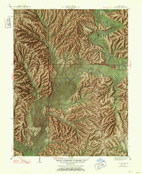
1947 Map of Allens Creek
USGS Topo · Published 1953About this map
Salt Creek winds through the deeply dissected uplands of southern Monroe County, defining a landscape of sharp ridges and isolated hollows long before the creation of the modern reservoir. The terrain is a network of family-named landmarks and small community hubs, including Fairfax and Payne Town Ch, which served the rural population gathered along the valley floors. Education and faith were anchored by a dense system of local institutions like Allens Creek Sch and Mt Ebal Ch, reflecting a time when travel was dictated by the winding courses of Brummett Creek and Phillipe Creek. Transportation across the main watercourses relied on structures like Hayes Bridge and Cutright Bridge. Genealogists will find significant value in the detailed placement of family burial grounds, such as Todd Cem and Lucas Cem, and the various schools and churches that once stood as the social centers of Polk and Salt Creek townships.
Find a feature on this map
49 named features on this map. Tap any name to fly to it.
Don’t see what you’re looking for? This feature index may not catch every label — zoom into the map to look around manually.
Map Details
Editions of this 1947 Allens Creek Map
Other maps of this area

1908 · Bloomington
USGS Topo · 1:48,000

1910 · Bloomington
USGS Topo · 1:62,500

1934 · Bedford
USGS Topo · 1:48,000

1935 · Oolitic
USGS Topo · 1:48,000

1937 · Bedford
USGS Topo · 1:62,500

1942 · Franklin
USGS Topo · 1:125,000

1942 · Oolitic
USGS Topo · 1:62,500

1946 · Belmont
USGS Topo · 1:24,000

1947 · Allens Creek
USGS Topo · 1:24,000

1947 · Unionville
USGS Topo · 1:24,000