
1947 Map of Allens Creek
USGS Topo · Published 1947About this map
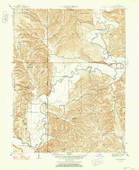
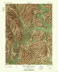
Salt Creek meanders deeply across this 1947 landscape, defining the character of southeastern Monroe County before later reservoir projects altered the valley. The map documents a rural society built on ridges and along creek bottoms, anchored by a dense network of local institutions like Allens Creek Ch and Burgoon Ch. Settlements such as Fairfax and Payne Town are visible alongside numerous family-named landmarks, including the Lucas Cem and Todd Cem. This survey was conducted just as the Second Principal Meridian was established as a primary surveying line through the center of the sheet. The intricate topography of Polk and Perry townships is captured in fine detail, showing the many hollows and branches like Jarrell Hollow and Miller Hollow that fed into the main river systems of Clear Creek and Salt Creek.
Find a feature on this map
53 named features on this map. Tap any name to fly to it.
Don’t see what you’re looking for? This feature index may not catch every label — zoom into the map to look around manually.
Map Details
Editions of this 1947 Allens Creek Map
Other maps of this area

1908 · Bloomington
USGS Topo · 1:48,000

1910 · Bloomington
USGS Topo · 1:62,500

1934 · Bedford
USGS Topo · 1:48,000

1935 · Oolitic
USGS Topo · 1:48,000

1937 · Bedford
USGS Topo · 1:62,500

1942 · Franklin
USGS Topo · 1:125,000

1942 · Oolitic
USGS Topo · 1:62,500

1946 · Belmont
USGS Topo · 1:24,000

1947 · Unionville
USGS Topo · 1:24,000

1947 · Elkinsville
USGS Topo · 1:24,000