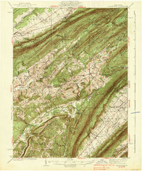
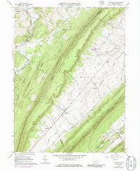
1938 Map of Allensville
USGS Topo · Published 1938About this map
The central Pennsylvania landscape of the 1930s is defined by the sharp parallel ridges of Tussey Mountain and Stone Mountain, which channel the movement of people and industry through narrow gaps and valleys. Settlement follows the water, with Standing Stone Creek and Shaver Creek anchoring agricultural and milling communities like McAlevys Fort and Ennisville. Evidence of the region’s earlier industrial era remains at Monroe Furnace and Greenwood Furnace, while the timber and grain economy is still visible through landmarks such as Compropst Mill and the community of Pine Grove Mills. A network of country schools, including Steffey Sch and Stone Valley Sch, dots the lower elevations of Warrior Ridge, reflecting a decentralized rural life before modern consolidation. Higher elevations show a shift toward forestry and conservation, highlighted by the Martin Gap CCC Camp and the Fire Tower at the intersection of several mountain ridges.
Find a feature on this map
90 named features on this map. Tap any name to fly to it.
Don’t see what you’re looking for? This feature index may not catch every label — zoom into the map to look around manually.
Map Details
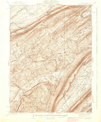
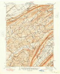
Editions of this 1938 Allensville Map
3 editions found
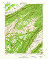
Historical Maps of Huntingdon Through Time
4 maps found
Featured Locations
- Huntingdon, PA
- Jackson Township, PA
- Miller Township, PA
- Menno Township, PA
- Pine Grove Mills, Ferguson Township