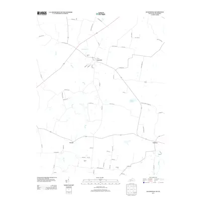
2013 Map of Allensville
USGS Topo · Published 2013About this map
Allensville serves as the primary hub of this landscape, situated near the northern edge where several local roads and rail lines converge. The settlement pattern is characterized by small communities and rural intersections such as Darnell and Keysburg, reflecting the agricultural heritage of the Kentucky-Tennessee border. This boundary is explicitly marked by State Line Rd, which separates the two states amid a network of family-named routes like Joe Gill Rd and Paul Hines Rd. The terrain is defined by the winding course of Elk Fork and its tributaries, including Rum Spring Cr, while Mosley Pond provides a significant water feature to the east. Numerous burial sites, including Belmont Cem, Mitchell Cem, and Wall Cem, are scattered across the quadrangle, offering essential locations for genealogical research and documenting the generational history of the families who settled this fertile river-bottom country.
Find a feature on this map
61 named features on this map. Tap any name to fly to it.
Don’t see what you’re looking for? This feature index may not catch every label — zoom into the map to look around manually.
Map Details
Editions of this 2013 Allensville Map
This is the sole edition of this map. No revisions or reprints were ever made.
Other maps of this area

1950 · Allensville
USGS Topo · 1:24,000

1950 · Guthrie
USGS Topo · 1:24,000

1950 · Olmstead
USGS Topo · 1:24,000

1951 · Elkton
USGS Topo · 1:24,000

1951 · Olmstead
USGS Topo · 1:24,000

1951 · Dot
USGS Topo · 1:24,000

1952 · Russellville
USGS Topo · 1:24,000

1952 · Springfield North
USGS Topo · 1:24,000

1956 · Nashville
USGS Topo · 1:250,000

1957 · Adams
USGS Topo · 1:24,000