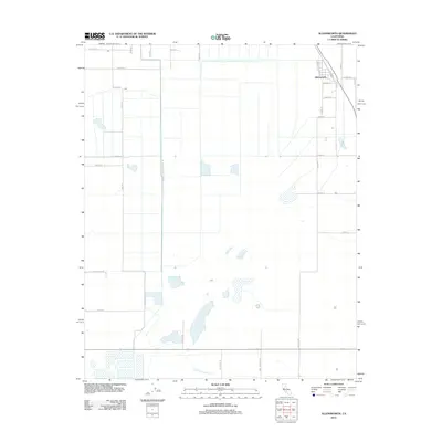
2012 Map of Allensworth
USGS Topo · Published 2012About this map
The settlement of Allensworth sits at the northeastern corner of this Tulare County landscape, defined by the organized grid of the San Joaquin Valley’s agricultural infrastructure. The territory is dominated by water management systems essential to local cultivation, most notably the Alpaugh Irrigation District Canal and the corresponding Alpaugh Irrigation Canal Rd. These man-made channels intersect with natural drainage patterns, such as the Old Channel Poso Cr in the southern portion of the quadrangle. The map captures a high degree of land division, marked by numbered thoroughfares like Avenue 46, Road 42, and Country Line Ave. This survey illustrates how the region's development was dictated by irrigation and the rigid township and range system, providing a clear view of the rural road network and water distribution channels that supported the community in the early twenty-first century.
Find a feature on this map
32 named features on this map. Tap any name to fly to it.
Don’t see what you’re looking for? This feature index may not catch every label — zoom into the map to look around manually.
Map Details
Editions of this 2012 Allensworth Map
This is the sole edition of this map. No revisions or reprints were ever made.
Other maps of this area

1914 · Lost Hills
USGS Topo · 1:125,000

1929 · Alpaugh
USGS Topo · 1:31,680

1929 · Hacienda Ranch
USGS Topo · 1:31,680

1929 · Pixley
USGS Topo · 1:31,680

1929 · West Alpaugh
USGS Topo · 1:31,680

1929 · Stone
USGS Topo · 1:31,680

1929 · Allensworth
USGS Topo · 1:31,680

1930 · Hamlin School
USGS Topo · 1:31,680

1930 · Pond
USGS Topo · 1:31,680

1930 · Miramonte Ranch
USGS Topo · 1:31,680