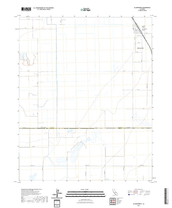
2021 Map of Allensworth
USGS Topo · Published 2021About this map
Allensworth stands as a focal point in this southern section of the San Joaquin Valley, situated within the expansive agricultural landscape of the Central Valley. The map documents a highly structured environment defined by a grid of rural routes such as Garces Hwy and Highway 43, which intersect with numerous numbered roads and avenues that facilitate the region's intense cultivation. Water management, a critical component of life in this arid landscape, is represented by the Alpaugh Irrigation District Canal and the Old Channel Poso Cr. The boundary between Tulare Co and Kern Co runs along Country Line Ave, marking a significant administrative division in this section of California. Genealogists and historians can trace the relationship between these early 21st-century infrastructure projects and the historic African American settlement of Allensworth.
Find a feature on this map
38 named features on this map. Tap any name to fly to it.
Don’t see what you’re looking for? This feature index may not catch every label — zoom into the map to look around manually.
Map Details
Editions of this 2021 Allensworth Map
This is the sole edition of this map. No revisions or reprints were ever made.
Other maps of this area

1914 · Lost Hills
USGS Topo · 1:125,000

1929 · Alpaugh
USGS Topo · 1:31,680

1929 · Hacienda Ranch
USGS Topo · 1:31,680

1929 · Pixley
USGS Topo · 1:31,680

1929 · West Alpaugh
USGS Topo · 1:31,680

1929 · Stone
USGS Topo · 1:31,680

1929 · Allensworth
USGS Topo · 1:31,680

1930 · Hamlin School
USGS Topo · 1:31,680

1930 · Pond
USGS Topo · 1:31,680

1930 · Miramonte Ranch
USGS Topo · 1:31,680