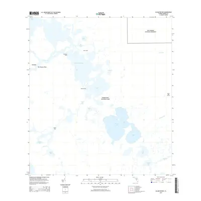
2015 Map of Alligator Bay
USGS Topo · Published 2015About this map
The Watson Place and the small settlement of Chatham stand as lone human outposts at the edge of a complex coastal labyrinth where the western Everglades National Park meets the Gulf of Mexico. This environment is defined by an intricate network of mangrove-lined water bodies, including Huston Bay, Cannon Bay, and Alligator Bay, connected by the Wilderness Waterway and various winding channels like the Chatham River. The presence of the Gator Bay Canal and Gator Bay Prairie suggests the delicate interface between freshwater wetlands and tidal estuaries. Moving inland toward the northeast, the terrain shifts as the map captures the transition into the Big Cypress National Preserve. Key geographic markers like Chevelier Point, Opossum Key, and Gopher Key provide navigational reference points for this water-dominated landscape, which includes remote locations like Lostmans Five and Plate Creek Bay.
Find a feature on this map
30 named features on this map. Tap any name to fly to it.
Don’t see what you’re looking for? This feature index may not catch every label — zoom into the map to look around manually.
Map Details
Editions of this 2015 Alligator Bay Map
This is the sole edition of this map. No revisions or reprints were ever made.
Other maps of this area

1956 · Miami
USGS Topo · 1:250,000

1958 · Miami
USGS Topo · 1:250,000

1972 · Big Boy Lake
USGS Topo · 1:24,000

1973 · Gator Hook Swamp
USGS Topo · 1:24,000

1973 · Pavilion Key
USGS Topo · 1:24,000
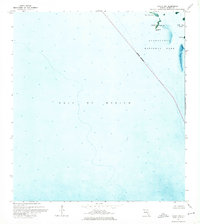
1973 · Plover Key
USGS Topo · 1:24,000

1973 · Monroe Station
USGS Topo · 1:24,000

1973 · Big Lostmans Bay
USGS Topo · 1:24,000

1973 · Lostmans River Ranger Station
USGS Topo · 1:24,000

1973 · Alligator Bay
USGS Topo · 1:24,000