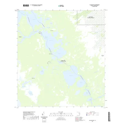
2021 Map of Alligator Bay
USGS Topo · Published 2021About this map
Everglades National Park and Big Cypress National Preserve meet in this aquatic landscape of the western Everglades. The map illustrates a complex network of brackish bays and tidal rivers, including the Chatham River and Chevelier Bay, where land and water are perpetually intertwined. Navigational routes like the Wilderness Waterway Trl and Everglades Paddling Trl snake through the mangroves, connecting remote landmarks such as Opossum Key and Gopher Key.
Find a feature on this map
40 named features on this map. Tap any name to fly to it.
Don’t see what you’re looking for? This feature index may not catch every label — zoom into the map to look around manually.
Map Details
Editions of this 2021 Alligator Bay Map
This is the sole edition of this map. No revisions or reprints were ever made.
Other maps of this area

1956 · Miami
USGS Topo · 1:250,000

1958 · Miami
USGS Topo · 1:250,000

1972 · Big Boy Lake
USGS Topo · 1:24,000

1973 · Gator Hook Swamp
USGS Topo · 1:24,000

1973 · Pavilion Key
USGS Topo · 1:24,000
1973 · Plover Key
USGS Topo · 1:24,000

1973 · Monroe Station
USGS Topo · 1:24,000

1973 · Big Lostmans Bay
USGS Topo · 1:24,000

1973 · Lostmans River Ranger Station
USGS Topo · 1:24,000

1973 · Alligator Bay
USGS Topo · 1:24,000