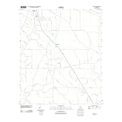
2011 Map of Alma NE
USGS Topo · Published 2011About this map
Sweetwater Creek defines the drainage of this rural Georgia landscape, flowing past small clusters of settlement such as Holmesville and Pine Forest. The map reveals a land divided by long-established family routes and timber roads, including Poor Robin Rd and Silas Black Brk. The presence of numerous family burial grounds, such as Graham Cemetery, Carter Cemetery, and Beckworth Cemetery, points to the deep-rooted genealogical history of the area near the northern headwaters of Big Satilla Creek. To the north, Weatherly Park serves as a local landmark near the winding path of Black Water Creek. The map documents a quiet, agrarian region defined more by its creek crossings and local road networks than by dense urbanization.
Find a feature on this map
72 named features on this map. Tap any name to fly to it.
Don’t see what you’re looking for? This feature index may not catch every label — zoom into the map to look around manually.
Map Details
Editions of this 2011 Alma NE Map
This is the sole edition of this map. No revisions or reprints were ever made.
Other maps of this area

1953 · Waycross
USGS Topo · 1:250,000

1958 · Waycross
USGS Topo · 1:250,000
1970 · Altamaha SW
USGS Topo · 1:24,000

1970 · Pine Grove
USGS Topo · 1:24,000

1970 · Baxley
USGS Topo · 1:24,000

1971 · Surrency
USGS Topo · 1:24,000

1971 · Coffee
USGS Topo · 1:24,000

1971 · K'ville
USGS Topo · 1:24,000

1971 · Alma NW
USGS Topo · 1:24,000

1971 · Alma
USGS Topo · 1:24,000