
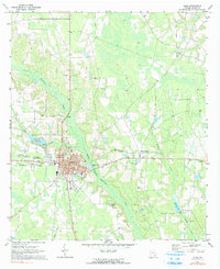
1971 Map of Alma
USGS Topo · Published 1974About this map
Alma serves as the focal point of this South Georgia landscape, situated at the intersection of several regional transport lines including the Seaboard Coast Line railroad. The town center is densely plotted around City Hall and the local Jr High Sch, surrounded by several historic family cemeteries such as Rose Hill Cem and Johnsons Cem. The surrounding terrain is defined by the winding course of Hurricane Creek and its tributaries, including Bear Branch and Rigdon Br, which cut through the low-lying wetlands and agricultural fields of Bacon County.
Find a feature on this map
30 named features on this map. Tap any name to fly to it.
Don’t see what you’re looking for? This feature index may not catch every label — zoom into the map to look around manually.
Map Details
Editions of this 1971 Alma Map
2 editions found
Other maps of this area

1953 · Waycross
USGS Topo · 1:250,000

1958 · Waycross
USGS Topo · 1:250,000

1971 · Nicholls NE
USGS Topo · 1:24,000

1971 · Coffee
USGS Topo · 1:24,000

1971 · Alma NW
USGS Topo · 1:24,000

1971 · Beach
USGS Topo · 1:24,000

1971 · Sessoms
USGS Topo · 1:24,000

1971 · Mershon
USGS Topo · 1:24,000
1971 · Alma NE
USGS Topo · 1:24,000
1971 · Crawley
USGS Topo · 1:24,000