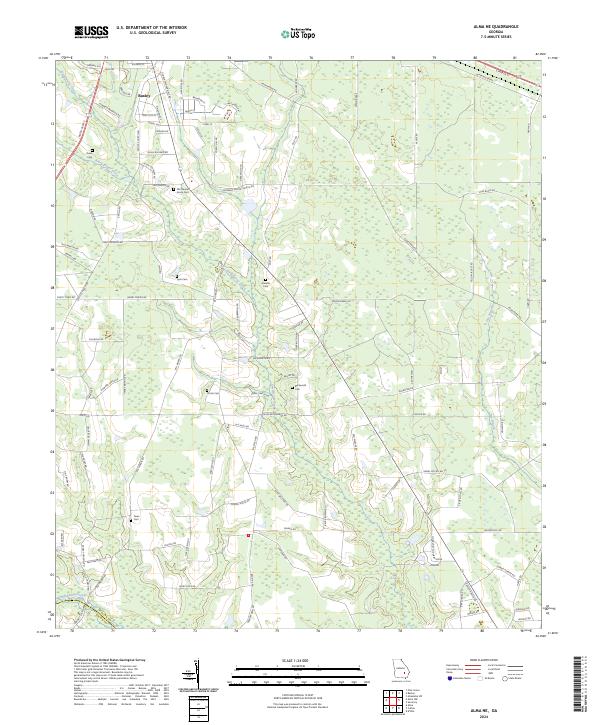
2024 Map of Alma NE
USGS Topo · Published 2024About this map
Baxley sits at the northern edge of this South Georgia landscape, where the residential grids of Oak Cliff St and Forest Ave give way to the sprawling timberlands and wetlands of the coastal plain. The terrain is defined by the winding paths of Sweetwater Creek and Black Water Creek, which cut through a mosaic of agricultural clearings and dense woods. For genealogists and local historians, the area is notable for its numerous small burial grounds, including the Old Pleasant Grove Cem and Graham Cem, which often represent the early foundations of rural families in Appling Co and Bacon Co. The drainage patterns, visible in features like Swain Break and Wheaton Break, illustrate the complex hydrology that influenced the placement of early roads such as Old Blackshear Hwy Rd.
Find a feature on this map
106 named features on this map. Tap any name to fly to it.
Don’t see what you’re looking for? This feature index may not catch every label — zoom into the map to look around manually.
Map Details
Editions of this 2024 Alma NE Map
This is the sole edition of this map. No revisions or reprints were ever made.
Other maps of this area

1953 · Waycross
USGS Topo · 1:250,000

1958 · Waycross
USGS Topo · 1:250,000
1970 · Altamaha SW
USGS Topo · 1:24,000

1970 · Pine Grove
USGS Topo · 1:24,000

1970 · Baxley
USGS Topo · 1:24,000

1971 · Surrency
USGS Topo · 1:24,000

1971 · Coffee
USGS Topo · 1:24,000

1971 · K'ville
USGS Topo · 1:24,000

1971 · Alma NW
USGS Topo · 1:24,000

1971 · Alma
USGS Topo · 1:24,000