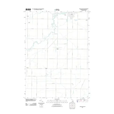
2011 Map of Alma South
USGS Topo · Published 2011About this map
Alma sits at the northern edge of this Gratiot County landscape, where the southern reaches of the city meet the meandering Pine River. The geography is defined by a dense grid of rural roads and agricultural plots, intersected by smaller waterways like Coles Creek and Honeyoey Creek. A significant industrial presence is noted in the northwest corner with the Sumner Oil Field, indicating the region's historical and ongoing ties to energy extraction.
Find a feature on this map
55 named features on this map. Tap any name to fly to it.
Don’t see what you’re looking for? This feature index may not catch every label — zoom into the map to look around manually.
Map Details
Editions of this 2011 Alma South Map
This is the sole edition of this map. No revisions or reprints were ever made.
Other maps of this area

1918 · Perrinton
USGS Topo · 1:62,500

1935 · Alma
USGS Topo · 1:62,500

1938 · Alma
USGS Topo · 1:62,500

1943 · Perrinton
USGS Topo · 1:62,500

1954 · Midland
USGS Topo · 1:250,000

1958 · Midland
USGS Topo · 1:250,000

1959 · Midland
USGS Topo · 1:250,000

1965 · Sumner
USGS Topo · 1:24,000
1965 · Perrinton
USGS Topo · 1:24,000
1965 · Pompeii
USGS Topo · 1:24,000