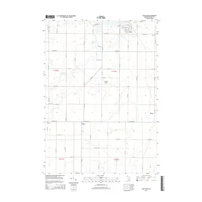
2014 Map of Alma South
USGS Topo · Published 2014About this map
The Pine River meanders through the heart of this central Michigan landscape, connecting the southern outskirts of Alma to the surrounding agricultural townships. The grid of rural roads, including N Ely Hwy and W Washington Rd, defines a territory marked by family heritage and local landmarks. Genealogists will find significant value in the distribution of burial sites across the quadrangle, from Riverside Cem and Pritchard Cem in the north to the Roosa Farm Cem and Bailey Cem further south and east. Modern infrastructure like the Gratiot Community Airport sits alongside historic watercourses such as Coles Creek and Honeyoey Creek. Small pockets of settlement like Eugene and the western edge of Ithaca provide anchor points for those tracing the development of Gratiot County’s township-and-range system near the headwaters of the Bad River.
Find a feature on this map
64 named features on this map. Tap any name to fly to it.
Don’t see what you’re looking for? This feature index may not catch every label — zoom into the map to look around manually.
Map Details
Editions of this 2014 Alma South Map
This is the sole edition of this map. No revisions or reprints were ever made.
Other maps of this area

1918 · Perrinton
USGS Topo · 1:62,500

1935 · Alma
USGS Topo · 1:62,500

1938 · Alma
USGS Topo · 1:62,500

1943 · Perrinton
USGS Topo · 1:62,500

1954 · Midland
USGS Topo · 1:250,000

1958 · Midland
USGS Topo · 1:250,000

1959 · Midland
USGS Topo · 1:250,000

1965 · Sumner
USGS Topo · 1:24,000
1965 · Perrinton
USGS Topo · 1:24,000
1965 · Pompeii
USGS Topo · 1:24,000