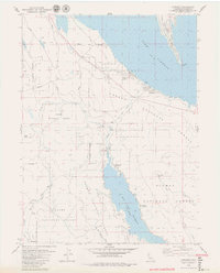
1979 Map of Almanor
USGS Topo · Published 1979About this map
Lake Almanor and the neighboring Butt Valley Reservoir dominate this landscape, reflecting the intensive water management and hydroelectric infrastructure of the late 1970s. The map illustrates a complex network of utility features, including an Intake Tower, a Surge Chamber, and a Powerhouse connected by a Penstock and Tunnel. These technical elements are juxtaposed against the small mountain communities of Almanor and Prattville.
Find a feature on this map
40 named features on this map. Tap any name to fly to it.
Don’t see what you’re looking for? This feature index may not catch every label — zoom into the map to look around manually.
Map Details
Editions of this 1979 Almanor Map
2 editions found
Other maps of this area

1886 · Lassen Peak
USGS Topo · 1:250,000

1892 · Lassen Peak
USGS Topo · 1:250,000

1894 · Lassen Peak
USGS Topo · 1:250,000

1955 · Almanor
USGS Topo · 1:62,500

1955 · Westwood
USGS Topo · 1:250,000

1956 · Mt. Harkness
USGS Topo · 1:62,500

1956 · Chester
USGS Topo · 1:62,500

1958 · Westwood
USGS Topo · 1:250,000

1958 · Jonesville
USGS Topo · 1:62,500

1959 · Westwood
USGS Topo · 1:250,000