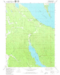
1979 Map of Almanor
USGS Topo · Published 1979About this map
Lake Almanor and the surrounding timberlands of the Lassen National Forest define this 1970s landscape in Plumas County. The map details a sophisticated hydroelectric system, tracing a tunnel and penstock from the lake down to a powerhouse at the head of Butt Valley Reservoir. Small settlements like Prattville and Almanor sit along the southwestern shore, while historic transportation routes like Humboldt Road and Humbug Road cut through the heavy forest cover.
Find a feature on this map
36 named features on this map. Tap any name to fly to it.
Don’t see what you’re looking for? This feature index may not catch every label — zoom into the map to look around manually.
Map Details
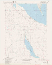
Editions of this 1979 Almanor Map
2 editions found
Other maps of this area

1886 · Lassen Peak
USGS Topo · 1:250,000

1892 · Lassen Peak
USGS Topo · 1:250,000

1894 · Lassen Peak
USGS Topo · 1:250,000

1955 · Almanor
USGS Topo · 1:62,500

1955 · Westwood
USGS Topo · 1:250,000

1956 · Mt. Harkness
USGS Topo · 1:62,500

1956 · Chester
USGS Topo · 1:62,500

1958 · Westwood
USGS Topo · 1:250,000

1958 · Jonesville
USGS Topo · 1:62,500

1959 · Westwood
USGS Topo · 1:250,000