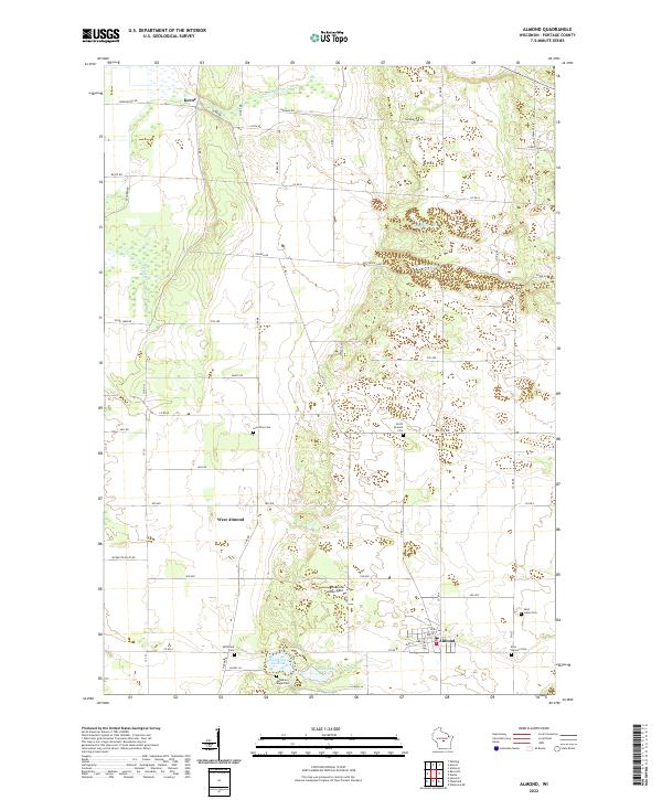
2022 Map of Almond
USGS Topo · Published 2022About this map
Almond and its surrounding townships in southern Portage County are defined by a complex network of small lakes and a significant number of rural cemeteries, reflecting the area's deep-rooted settlement history. From the northern hamlet of Keene down through West Almond, the landscape is dotted with several distinct burial sites including Lone Pine Cem, North Almond Cem, and Spiritland Cem, providing valuable data for genealogists and local historians.
Find a feature on this map
28 named features on this map. Tap any name to fly to it.
Don’t see what you’re looking for? This feature index may not catch every label — zoom into the map to look around manually.
Map Details
Editions of this 2022 Almond Map
This is the sole edition of this map. No revisions or reprints were ever made.
Other maps of this area

1955 · Green Bay
USGS Topo · 1:250,000

1957 · Amherst
USGS Topo · 1:48,000

1957 · Whiting
USGS Topo · 1:48,000

1958 · Coloma
USGS Topo · 1:48,000

1959 · Wautoma
USGS Topo · 1:48,000

1968 · Plainfield
USGS Topo · 1:24,000

1968 · Hancock
USGS Topo · 1:24,000
1968 · Wautoma NE
USGS Topo · 1:24,000
1969 · Blaine
USGS Topo · 1:24,000

1969 · Arnott
USGS Topo · 1:24,000