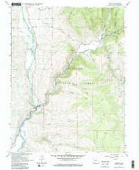
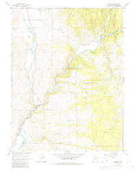
1964 Map of Almont
USGS Topo · Published 1980About this map
The confluence of the Taylor River and the East River at Almont forms the headwaters of the Gunnison River in this 1964 survey. This mountainous region of Gunnison County is characterized by deep drainage systems like Browns Canyon and Lost Canyon Gulch, which cut through the southern reaches of the Gunnison National Forest. The landscape reveals a transition from traditional river-valley settlement to specialized land use, evidenced by the Roaring Judy Fish Hatchery and the irrigation infrastructure of the Highline Canal.
Find a feature on this map
44 named features on this map. Tap any name to fly to it.
Don’t see what you’re looking for? This feature index may not catch every label — zoom into the map to look around manually.
Map Details
Editions of this 1964 Almont Map
5 editions found
Other maps of this area

1888 · Crested Butte
USGS Topo · 1:62,500

1889 · Crested Butte
USGS Topo · 1:62,500

1893 · Crested Butte
USGS Topo · 1:62,500

1934 · Taylor Park
USGS Topo · 1:62,500

1937 · Taylor Park
USGS Topo · 1:62,500

1941 · Pitkin
USGS Topo · 1:62,500

1945 · Pitkin
USGS Topo · 1:62,500

1954 · Gunnison
USGS Topo · 1:24,000

1956 · Montrose
USGS Topo · 1:250,000

1959 · Montrose
USGS Topo · 1:250,000