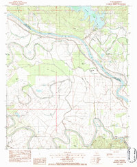
1983 Map of Aloha
USGS Topo · Published 1984About this map
The Red River serves as a winding boundary between Natchitoches and Grant Parishes, defining a landscape of complex waterways and seasonal lakes. The settlement of Aloha sits along the Kansas City Southern railroad, adjacent to the Aloha Oil Field, illustrating the intersection of transportation and local industry. To the southwest, the Cane River meanders through the lower terrain, punctuated by community landmarks such as St Simons Ch and St Marys Ch. The presence of the Little Eva Plantation Landing Strip near Blanchard Lake highlights the agricultural operations that occupy the fertile bottomlands. Numerous oxbows and backwaters like Lake Cocodrie and Nantachie Lake suggest a river system with a dynamic history of shifting channels. Genealogists may find interest in the Marco Cem and various rural churches that served the small communities of Odra, Aigle, and Marco.
Find a feature on this map
46 named features on this map. Tap any name to fly to it.
Don’t see what you’re looking for? This feature index may not catch every label — zoom into the map to look around manually.
Map Details
Editions of this 1983 Aloha Map
2 editions found
Other maps of this area

1932 · Colfax SW
USGS Topo · 1:31,680

1932 · Colfax NW
USGS Topo · 1:31,680

1935 · Verda
USGS Topo · 1:31,680

1936 · Colfax
USGS Topo · 1:62,500

1937 · Chopin NE
USGS Topo · 1:31,680

1937 · Chopin NW
USGS Topo · 1:31,680

1937 · Aloha
USGS Topo · 1:31,680

1937 · Montgomery
USGS Topo · 1:62,500

1937 · Cloutierville
USGS Topo · 1:31,680

1941 · Boyce
USGS Topo · 1:62,500