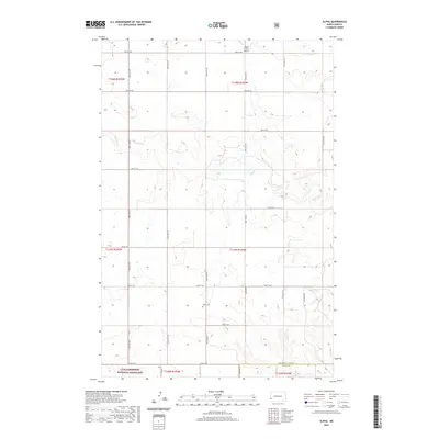
2020 Map of Alpha
USGS Topo · Published 2020About this map
The Little Missouri National Grassland dominates the southern landscape of this Alpha quadrangle, where the expansive prairie meets the drainage network of Bullion Cr. This region of western North Dakota is defined by its grid-based section lines and isolated landmarks that speak to a dispersed rural community. Central to the area's local history is the Alpha Cem, located near the intersection of 160th Ave SW and 52nd St SW, serving as a silent anchor for the township's genealogy. Aviation and industry mark the northern reaches, evidenced by Boyd's Turf Airport and a prominent Pipeline Rd cutting across the northern tiers. The terrain is navigated by a network of named county roads, including Red Hills Rd and Van Daele Rd, which connect the homesteads and ranching tracts across the Golden Valley and Slope County border.
Find a feature on this map
29 named features on this map. Tap any name to fly to it.
Don’t see what you’re looking for? This feature index may not catch every label — zoom into the map to look around manually.
Map Details
Editions of this 2020 Alpha Map
This is the sole edition of this map. No revisions or reprints were ever made.
Other maps of this area

1953 · Dickinson
USGS Topo · 1:250,000

1957 · Dickinson
USGS Topo · 1:250,000

1979 · Sentinel Butte SE
USGS Topo · 1:24,000

1979 · Three V Crossing
USGS Topo · 1:24,000

1979 · Square Butte
USGS Topo · 1:24,000

1980 · Golva
USGS Topo · 1:24,000

1980 · Spring Creek
USGS Topo · 1:24,000

1980 · Thelan
USGS Topo · 1:24,000

1980 · Alpha
USGS Topo · 1:24,000

1980 · Belfield
USGS Topo · 1:100,000