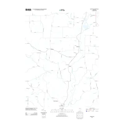
2013 Map of Alpine
USGS Topo · Published 2013About this map
The Whitewater River valley defines the central corridor of this area, where the river winds past the small settlements of Nulltown and Alpine. The geography is shaped by an intricate network of tributaries, including Pot Cr, Fall Cr, and the branching waters of N Br Garrison Cr and S Br Garrison Cr. To the south, the terrain becomes more defined near Mount Auburn and Laurel, while Champion Acre Lake provides a notable inland water feature in the southwest quadrant. The landscape exhibits a classic Midwestern rural grid, intersected by county roads and the natural, meandering paths of creeks such as Williams Cr and Bear Cr. The proximity of these small hamlets along the river suggests a long-standing reliance on the valley for transportation and local commerce, maintaining a character of dispersed agricultural settlement and quiet riverfront communities.
Find a feature on this map
102 named features on this map. Tap any name to fly to it.
Don’t see what you’re looking for? This feature index may not catch every label — zoom into the map to look around manually.
Map Details
Editions of this 2013 Alpine Map
This is the sole edition of this map. No revisions or reprints were ever made.
Other maps of this area

1953 · Cincinnati
USGS Topo · 1:250,000

1956 · Everton
USGS Topo · 1:24,000

1956 · Alpine
USGS Topo · 1:24,000

1956 · Brownsville
USGS Topo · 1:24,000

1956 · Metamora
USGS Topo · 1:24,000

1956 · Connersville
USGS Topo · 1:24,000

1956 · Brookville
USGS Topo · 1:24,000

1957 · Cincinnati
USGS Topo · 1:250,000

1958 · Clarksburg
USGS Topo · 1:24,000

1959 · New Salem
USGS Topo · 1:24,000