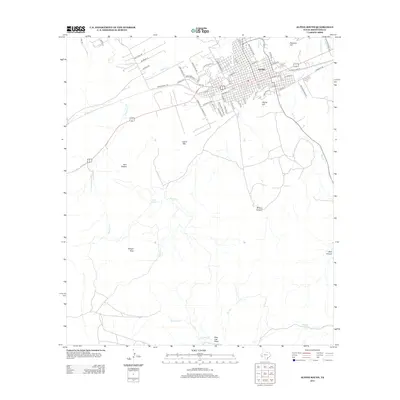
2012 Map of Alpine South
USGS Topo · Published 2012About this map
Sul Ross State Univ anchors the northeastern corner of this West Texas landscape, marking the transition from the city of Alpine to the rugged high desert terrain that characterizes the Trans-Pecos. The map details the residential expansion of the area including the Gray Addition and the suburban layout north of FM-1703. Beyond the city limits, the terrain rises sharply toward prominent landmarks like Hancock Hill and Alpine Hill, while the western portion is dominated by the elevations of Lizard Mtn and the iconic Twin Sisters.
Find a feature on this map
66 named features on this map. Tap any name to fly to it.
Don’t see what you’re looking for? This feature index may not catch every label — zoom into the map to look around manually.
Map Details
Editions of this 2012 Alpine South Map
This is the sole edition of this map. No revisions or reprints were ever made.
Other maps of this area

1895 · Alpine
USGS Topo · 1:125,000

1954 · Fort Stockton
USGS Topo · 1:250,000

1958 · Fort Stockton
USGS Topo · 1:250,000

1972 · Bird Mountain
USGS Topo · 1:24,000

1972 · Alpine North
USGS Topo · 1:24,000

1972 · Paisano
USGS Topo · 1:24,000

1972 · Mitre Peak
USGS Topo · 1:24,000

1972 · Alpine South
USGS Topo · 1:24,000

1972 · Elam Mountain
USGS Topo · 1:24,000

1973 · Fort Stockton
USGS Topo · 1:250,000