
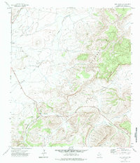
1972 Map of Alpine North
USGS Topo · Published 1975About this map
Alpine sits at the southern edge of this 1970s survey, where the high desert terrain transitions into the foothills of the Davis Mountains. The city's northern expansion is marked by the Municipal Airport and a Radio Facility, reflecting the infrastructure of Brewster County during this era. High-altitude ranching life is anchored at the Merriwether Ranch, situated west of the prominent drainage of Musquiz Creek. The landscape is defined by the sharp descent of Musquiz Canyon and the winding paths of Toronto Creek and Alpine Creek. A critical corridor for trade and travel, the Atchison Topeka and Santa Fe railroad cuts across the plateau, following the natural contours of the land. Evidence of local utility and industry appears near the town limits, including Sewage Disposal Ponds and several Gravel Pits used for local development.
Find a feature on this map
30 named features on this map. Tap any name to fly to it.
Don’t see what you’re looking for? This feature index may not catch every label — zoom into the map to look around manually.
Map Details
Editions of this 1972 Alpine North Map
This is the sole edition of this map. No revisions or reprints were ever made.
Other maps of this area

1894 · Fort Davis
USGS Topo · 1:125,000

1895 · Alpine
USGS Topo · 1:125,000

1897 · Fort Davis
USGS Topo · 1:125,000

1954 · Fort Stockton
USGS Topo · 1:250,000

1958 · Fort Stockton
USGS Topo · 1:250,000

1972 · Bird Mountain
USGS Topo · 1:24,000
1972 · Fort Davis SE
USGS Topo · 1:24,000

1972 · Paisano
USGS Topo · 1:24,000

1972 · Mitre Peak
USGS Topo · 1:24,000

1972 · Alpine South
USGS Topo · 1:24,000