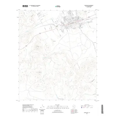
2019 Map of Alpine South
USGS Topo · Published 2019About this map
The high-elevation desert landscape of Alpine anchor the northern edge of this 2019 survey, where the town’s residential grid meets the surrounding peaks and canyons. The topography is defined by prominent igneous formations such as Twin Sisters, Lizard Mtn, and Ranger Peak, which create a rugged backdrop for the city. Significant local history sites are found on the eastern outskirts, including Elm Grove Cem and Holy Angels Cem near the banks of Moss Creek. Water management in this arid environment is evident through features like Baylor Tank, Ranger Spring, and the various draws like Deer Lick Draw and L-H Draw. The map details the drainage patterns of Paisano Creek and McIntyre Creek, showing how these ephemeral waterways shape the canyons below Hancock Hill and Sierra La Rana.
Find a feature on this map
101 named features on this map. Tap any name to fly to it.
Don’t see what you’re looking for? This feature index may not catch every label — zoom into the map to look around manually.
Map Details
Editions of this 2019 Alpine South Map
This is the sole edition of this map. No revisions or reprints were ever made.
Other maps of this area

1895 · Alpine
USGS Topo · 1:125,000

1954 · Fort Stockton
USGS Topo · 1:250,000

1958 · Fort Stockton
USGS Topo · 1:250,000

1972 · Bird Mountain
USGS Topo · 1:24,000

1972 · Alpine North
USGS Topo · 1:24,000

1972 · Paisano
USGS Topo · 1:24,000

1972 · Mitre Peak
USGS Topo · 1:24,000

1972 · Alpine South
USGS Topo · 1:24,000

1972 · Elam Mountain
USGS Topo · 1:24,000

1973 · Fort Stockton
USGS Topo · 1:250,000